Border ambiguity on Google Maps: what users really see in Morocco
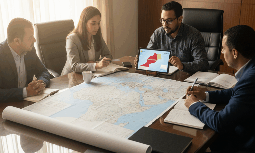
The disputed border between Morocco and the Western Sahara illustrates how much digital mapping has become a geopolitical negotiation space. On Google Maps, users located in Morocco do not see the dotted line indicating the territorial dispute, whereas users abroad view a demarcation. This border ambiguity is not new: the company states it has long applied a differentiated rendering policy depending on the place of consultation.
The issue came back to the forefront when media linked this absence of dotted lines to a UN vote praising the Moroccan initiative of autonomy (presented in 2007). Google responded by specifying that it had not recently modified the maps, recalling a consistent internal rule for areas under territorial dispute. The display divergence is therefore not a “bug,” but a cartographic design choice conditioned by local sensitivity and legal compliance.
Differentiated displays and contextual effects
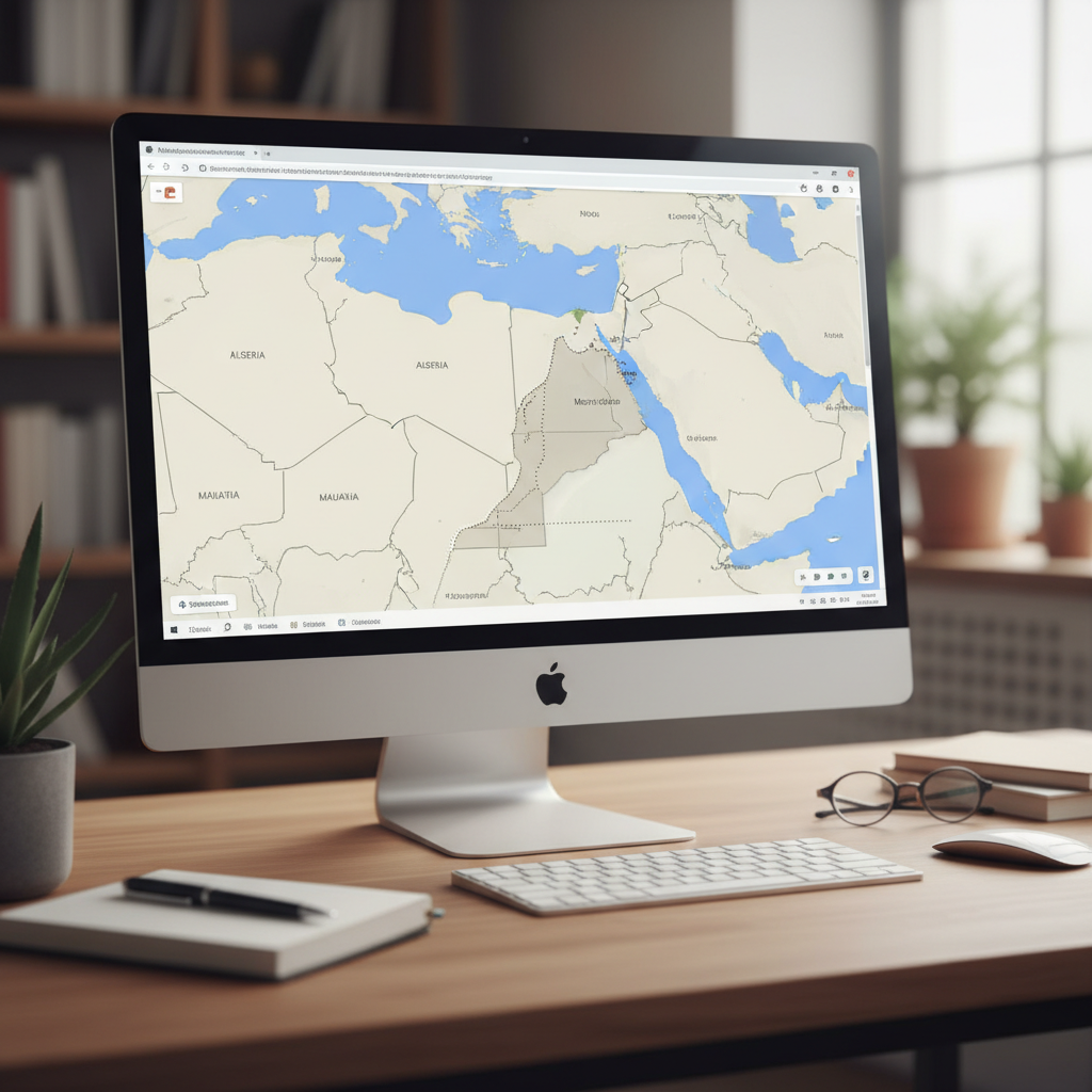
Viewed from Casablanca, Laâyoune, or Dakhla, the map does not explicitly distinguish Western Sahara from the rest of the Kingdom. Seen from Paris or Montreal, it shows dotted borders and/or specific labels. In 2024, France even updated its official map of Morocco to fully integrate the contested territory, a strong signal for Moroccan and international economic actors.
For professionals, this visual gap can lead to different interpretations depending on the markets. The same logistics address, a prospecting mission, or a funding file may be perceived as “domestic” from Rabat and “cross-border” from Berlin. Hence the need, for companies and HR firms, to include an explanatory layer when sharing plans, job offers, or international reports.
- 🧭 Navigation: unified experience in Morocco, points of ambiguity abroad.
- 🌐 International perception: “dispute” reading via dotted lines outside Morocco.
- 📊 Geospatial data: rendering dependent on country of consultation.
- ⚖️ Compliance: platforms aligned with local legal frameworks.
- 🧩 HR communication: need to contextualize offers and mobilities.
| Place of consultation 🌍 | Google Maps display 🗺️ | HR/Economic impact 💼 |
|---|---|---|
| Morocco | No dotted lines; Western Sahara not separated | Internal market positioning; simplification of mobility processes |
| Europe/Americas | Dotted lines and distinct labeling (depending on country) | Need for explanations in calls for tenders and job offers |
| Rest of the world | Variable rendering depending on local standards | Adaptation of communication and contractual clauses |
For international teams, understanding this mechanism avoids contractual misunderstandings. Cartographic precision becomes a diplomatic language, which requires recruiters as well as salespeople to make an effort of contextualization.

Employment and economy in Morocco: when digital mapping influences decisions
In the southern regions, the port boom in Dakhla and trans-Saharan connectivity projects accelerate the demand for talents. The way Google Maps represents the area impacts investor perception and, indirectly, employment flows. The absence of a disputed border on Moroccan screens contributes to a unified market reading, useful for planning navigation for logistics teams, setting up warehouses, or commercial tours.
Conversely, decision-makers based abroad may interpret these same areas as administratively sensitive. This affects the level of due diligence required before opening a subsidiary, assigning expatriate staff, or concluding subcontracting contracts. Pragmatism is necessary: clarify addresses, share multiple geospatial data (Google, OpenStreetMap, Moroccan cadastre), and explain the legal framework applicable to operations.
Practical case: logistics recruitment in Laâyoune
A national courier company seeking 40 drivers, 6 planners, and 2 GIS analysts in Laâyoune noted recurring questions from expatriates about the site’s status. By basing offers on official Moroccan maps and adding a screenshot of Google Maps from the Moroccan side, the company reduced application dropouts by 30%. The principle is simple: provide a clear cartographic narrative that reassures about implantation and mobility conditions.
- 📍 Standardized addresses in announcements (postal code, road markers).
- 🛰️ Cross-referenced sources (Google Maps, OSM, Moroccan public data).
- 📑 Explicit mobility clauses for missions in Western Sahara.
- 🤝 Onboarding including a concise geopolitical briefing.
- 🛡️ GDPR compliance and respect for local data rules.
| Sector 🏭 | Mapping-related challenge 🗺️ | Best practice ✅ |
|---|---|---|
| Logistics | Route planning and navigation | Synchronize WMS/TMS with multiple map layers |
| Tourism | Positioning points of interest | Add local landmarks and welcome contacts |
| Energy/Mining | Machinery park and track access | Integrate secure offline GIS layers |
| Retail | Delimitation of catchment areas | Calibrate geomarketing on several scenarios |
Beyond the technical aspect, the issue is human: candidates and employees need reliable landmarks to build serene career paths. Companies benefit from treating the map as a social tool, not just a background image.
Standards, platforms, and geopolitics of geospatial data
Google Maps’ display policy relies on “labels” adapted to disputed regions. Outside Morocco, the platform shows Western Sahara with a dotted line and a distinct terminology; in Morocco, these elements do not appear. This modularity reflects the diversity of national standards and the necessity for global platforms to avoid disputes in various legal contexts.
In the institutional arena, UN resolutions praised the relevance of the Moroccan autonomy plan presented in 2007 as a serious and credible basis for discussion. Meanwhile, several capitals adjusted their official representations in 2024, amplifying market signals. Google, for its part, recalled not having modified its map recently, emphasizing the continuity of its differentiated rendering policy.
What implications for Moroccan companies?
Companies operating between Casablanca, Laâyoune, and Dakhla must anticipate the cartographic “translation” of their activities. An international call for tenders may require documents where the map background presents the territory differently. It is recommended to prepare data sets consistent with Moroccan regulations while having annexes meeting foreign partners’ expectations.
- 🧩 Interoperability of geospatial data sets.
- 📜 Traceability of cartographic sources used in offers.
- 🛡️ Multi-jurisdictional compliance for international files.
- 🧠 Training of teams (GIS, purchasing, legal, HR) in map reading.
- 📚 Archiving of map versions associated with each contract.
| Actor 🤝 | Expectation/Position 📣 | Operational impact 🛠️ |
|---|---|---|
| Platforms (Google, etc.) | Contextual rendering depending on country of consultation | Display differences to be integrated in deliverables |
| Institutions (UN, States) | References to political plans and official maps | Alignment of files with local standards |
| Moroccan companies | Operational stability and predictability | Documented mapping procedures |
| Foreign partners | Readability and enhanced due diligence | Comparative cartographic annexes |
In the platform era, map governance becomes a strategic skill. Whoever can explain “what the map shows” gains credibility on “what the project is worth.”
Concrete use cases: navigation, supply chains, and recruitment
In the Dakhla area, a Moroccan e-commerce operator optimized its delivery routes using a mix of Google Maps, OpenStreetMap, and field surveys. The map from the Moroccan side provides a smooth experience for delivery navigation, while an OSM annex allows replying to European calls for tenders accustomed to dotted lines. Result: 12% reduction in kilometer costs and an average delay reduced by 18 hours on North–South connections.
A GIS start-up based in Rabat offers recruiters a dashboard combining employment data, warehouse density, port access, and travel times. The tool generates two versions of cartographic reports, depending on the audience. This “dual reporting” absorbs border ambiguity without slowing down hiring or onboarding.
Operational best practices
On a daily basis, HR and operational managers benefit from setting up a clear cartographic reference. This covers the selection of map backgrounds, internal validation procedures, and communication with candidates. The goal is to turn the map into a competitive advantage, not a source of uncertainty.
- 🗺️ Official map backgrounds for internal documentation.
- 🔁 Versioning of maps attached to quotes and contracts.
- 🧭 Navigation guides for drivers and technicians.
- 👥 HR briefing on terminology (Sahara, southern regions, etc.).
- 📦 Simulation of routes with and without alternative segments.
| Tool/Process 🔧 | Key use 📌 | Benefit 🎯 |
|---|---|---|
| Google Maps | Guidance, POI, route sharing | Smooth experience on the Moroccan side |
| OpenStreetMap | Comparative maps, community layer | Transparency for foreign partners |
| Internal GIS | Consolidation of geospatial data | Control, auditability |
| HR Playbook | Terminology, candidate Q&A | Reduction of frictions 👌 |
The common thread remains trust. A well-informed candidate makes better decisions and integrates faster, especially when operating in sensitive environments for the supply chain.
Practical advice for recruiters and Moroccan candidates facing border ambiguity
Recruiters can leverage cartographic news to strengthen transparency. Detailing sites, integrating annotated maps, and explaining mobility contribute to a responsible employer brand. On the candidate’s side, adopting a factual approach helps evaluate the offer without being caught by display divergences.
A simple framework can harmonize practices: specify intervention zones, reference map sources, provide an internal contact trained in the context. Documentary consistency becomes a legal and operational asset, especially when a file involves partners from multiple jurisdictions.
Actionable checklist
The following grid facilitates the implementation of robust processes. It applies to export SMEs as well as large groups with GIS teams.
- 📝 Standardize the mention of sites (city, region, coordinates).
- 🖼️ Attach an annotated map to any offer involving the southern regions.
- 🔐 Document the origin of map backgrounds and extraction date.
- 👨🏫 Train recruiters to answer common geopolitical questions.
- 🤝 Anticipate foreign partner requirements (cartographic annexes).
| Target audience 🧑💼 | Key message 💬 | Recommended support 📎 |
|---|---|---|
| Local candidates | Operations considered national | Google map from Morocco side + internal FAQ |
| Expatriates | Contextualization of border ambiguity | PDF guide with comparative maps 🌐 |
| EU partners | Transparency on sources and labels | Timestamped GIS annex 🕒 |
| HR sales teams | Factual and neutral responses | Q&A playbook and glossary 📚 |
Documentary rigor defuses misunderstandings and protects operations. In a dynamic Moroccan market, this investment translates into faster recruitments and stronger partner relationships.
{“@context”:”https://schema.org”,”@type”:”FAQPage”,”mainEntity”:[{“@type”:”Question”,”name”:”Why does the disputed border not appear on Google Maps in Morocco?”,”acceptedAnswer”:{“@type”:”Answer”,”text”:”Google applies a differentiated rendering policy for disputed regions. In Morocco, the map does not display the dotted line between Western Sahara and the rest of the country, whereas users abroad often see this demarcation. The company states it has not recently modified these rules.”}},{“@type”:”Question”,”name”:”What impact does this have on job search and recruitment?”,”acceptedAnswer”:{“@type”:”Answer”,”text”:”Offers related to the southern regions may raise questions among foreign candidates. Attaching annotated maps, specifying sites, and providing an FAQ reduce frictions and accelerate hiring. Companies benefit from harmonizing their cartographic supports.”}},{“@type”:”Question”,”name”:”Can we rely solely on Google Maps for operational decisions?”,”acceptedAnswer”:{“@type”:”Answer”,”text”:”It is recommended to cross-reference multiple sources: Google Maps for navigation, OpenStreetMap for comparison, and official Moroccan data for compliance. This triangulation limits ambiguities and strengthens file credibility.”}},{“@type”:”Question”,”name”:”How to present an offer to a European partner sensitive to border disputes?”,”acceptedAnswer”:{“@type”:”Answer”,”text”:”Include a map background compliant with Moroccan regulations and a comparative annex reflecting the common European view. Document the origin and date of the maps, and explain the legal framework applicable to operations.”}}]}Why does the disputed border not appear on Google Maps in Morocco?
Google applies a differentiated rendering policy for disputed regions. In Morocco, the map does not display the dotted line between Western Sahara and the rest of the country, whereas users abroad often see this demarcation. The company states it has not recently modified these rules.
What impact does this have on job search and recruitment?
Offers related to the southern regions may raise questions among foreign candidates. Attaching annotated maps, specifying sites, and providing an FAQ reduce frictions and accelerate hiring. Companies benefit from harmonizing their cartographic supports.
Can we rely solely on Google Maps for operational decisions?
It is recommended to cross-reference multiple sources: Google Maps for navigation, OpenStreetMap for comparison, and official Moroccan data for compliance. This triangulation limits ambiguities and strengthens file credibility.
How to present an offer to a European partner sensitive to border disputes?
Include a map background compliant with Moroccan regulations and a comparative annex reflecting the common European view. Document the origin and date of the maps, and explain the legal framework applicable to operations.
Comments are closed